A personal encounter with the people and places of the American Southwest

Friday, October 31, 2014

Curbside Nature


Grand Junction, Colorado 

I have long been fascinated by places where the natural and urban worlds intersect. An abandoned factory choked by foxtail barley, sumac, and snakeweed is an intriguing maze of metal and cellulose. A decommissioned iron girder bridge presents a paradise for barn swallows and their oval mud-daubed nests all in a row. And while it is always a delight to find a beaver dam, the discovery is just a touch surreal when suburban tract houses are within view of the structure’s tangled branches.
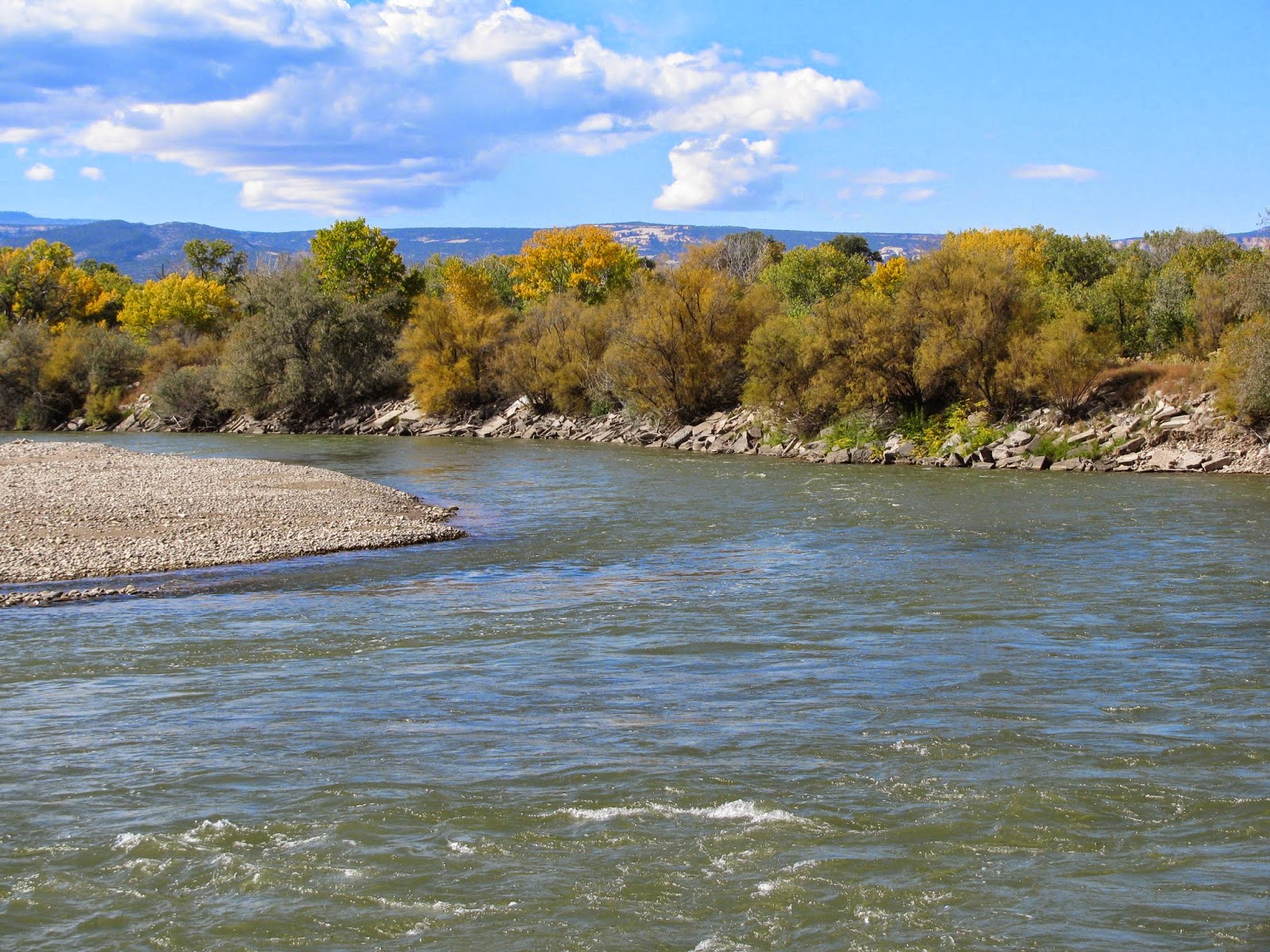
Here in Grand Junction, Colorado, there are many interzones where nature penetrates the works of humanity. This is partly due to the city’s modest size – the whole Grand Valley, home to a string of small cities, is a bit over 100,000 in population. In addition, a semi-arid wilderness surrounds the valley, so that the city edges out into vast stretches of unsettled canyons and mesas.

But perhaps the most important source for Grand Junction’s areas of untamed flora and fauna is the Colorado River. Grand Junction is the largest metropolis on the Colorado’s 1500 mile passage from La Poudre Pass in the Rocky Mountains to Mexico’s Sea of Cortez. The river divides the city, and the municipal and state governments have kept Junction’s riverbanks largely undeveloped, preserving them as wetlands. Thus, in Grand Junction, surrounded by homes and businesses, streets and highways, the Colorado is a corridor for the natural world.
Along much of this corridor, city and state agencies have constructed a series of trails, and after a long day in the classroom, I often head for the Colorado River Trail system. There, sometimes mere yards from city streets, I can walk through groves of cottonwoods, Russian olive, and tamarisk, skirting lakes, streams, canals, and sometimes the river itself.

A partial list of the natural denizens I have spotted near these trails includes cottontail rabbits, jack rabbits, gray squirrels, mule deer, beaver, great horned owls, red-tailed hawks, Swainson’s hawks, northern flickers, orioles, ravens, magpies, great blue herons, Canadian geese, mallards, wood ducks, spadefoot toads, leopard frogs, whiptail lizards, garter snakes, praying mantis, and monarch butterflies. Once I walked through hundreds of golden dragonflies mysteriously swarming around a fallen cottonwood trunk; another time I came upon a nest filled with newly hatched mallard ducklings. There are often surprises like these, natural encounters I would expect in the deep wilds, not within the sound of car horns.

Now, I do not want to give the impression that these trails are untouched wilderness. The city certainly intrudes. On the trail that skirts Corn Lake, where massive cottonwoods face high shale bluffs along the Colorado, the thrumming sound of the Halliburton plant is frequently an unavoidable irritation. Along much of the trail, one can hear the snap and buzz of the high tension power lines overhead. Occasionally, the smell of diesel exhaust wafts through the air. Drained beer cans, used disposable diapers, and charred fast-food wrappers grace the trail’s border. One day I came upon an unlabeled five gallon glass jug sitting alone in the midst of an alkaline flat, a strange mystery my terrier-mix dog Myla approached with great trepidation. And tucked away in the tamarisk labyrinths stand the homeless camps, their plywood lean-tos and canvas shelters a reminder of our nation’s economic and social inequities.

Still, the Colorado River Trail system provides a quick escape from the city’s tame landscape, reminding us that despite all the recent urban and industrial development in the Southwest, nature is still in charge. As Frank Waters expresses it in his exemplary portrait of the region, The Colorado (Swallow Press, 1946): “This is a country where the land predominates, not man. It contains the highest peaks, the largest mountain ranges, the widest plateaus, the deepest cañons, and the lowest deserts in America. Geology here forever dominates life and gives it its ultimate meaning” (4).


Postscript

There is a wonderfully written review by Suellen Alfred of Land of Cinnamon Sun in the on-line creative non-fiction magazine Under the Sun. You can access it at http://underthesunonline.com/review-of-nizalowskis-land-of-cinnamon-sun/

In addition, there is a nicely done photo feature of Land of Cinnamon Sun and other offerings from Irie Books in a blog run by Longhouse Publishers & Bookstore. The other books pictured with my collection are The Street by Aram Saroyan and Places of Mystery, Power, and Energy by Bill Worrell, again all on Irie Books. You can access this feature at http://longhousepoetryandpublishers.blogspot.com/2014/09/irie-books.html

Also of interest: Grand Canyon Backpacking Stories edited by Rick Kempa is the first-ever anthology devoted to the Grand Canyon backpacking experience. In it, twenty-seven writers offer tales that encompass the full range of the canyon backcountry experience: adventure, discovery, danger, deep solitude. Novice hikers express their wide-eyed wonder, while veteran canyoneers reflect on how the place has shaped their character. Rangers, trail workers, scientists, and guides provide unique perspectives. Writing from the corridor trails, the backcountry trails, and the vast canyon wilderness, the authors offer intimate views of what it is like to be afoot beneath the rim. For more information, visit http://www.vishnutemplepress.com/.  To read the table of contents and the introduction, visit rickkempa.com.


Tuesday, October 7, 2014

Gods of Fire, Gods of Stone


Bird Springs, Arizona  

I recently journeyed to Flagstaff for a few days to see my youngest daughter, Isadora, a chemistry major at Northern Arizona University. It was a rather rushed visit, but we did find the time to buy several vintage vinyl records at Bookman’s, drink a mocha at Macy’s, and grab an egg sandwich for breakfast at the Galaxy Diner.

Normally to get back home to Grand Junction, I drive straight north on U.S. 89 to U.S. 160, head northeast through Tuba City and Kayenta to Mexican Water. In Mexican Water, I catch U.S. 191 north all the way through Moab, Utah to Interstate 70. I take this east to Junction, which is just over the Colorado line. It’s a wonderful drive through some of the Southwest’s most interesting landscapes – the pyramidal peaks of the San Francisco Mountains, the Moenkopi Plateau’s Painted Desert, Kletha Valley with its twisted canyons, the mysterious frozen wave of Comb Ridge, the high bluffs surrounding the San Juan River, the Utah canyon lands’ easternmost reaches, and the towering La Sal Mountains. Visually, the La Sal Mountains closely echo the San Francisco Peaks, and both snow-capped ranges create perfect bookends for the drive. They also possess a strong mythological parallel: the La Sals are the home of the Ute Sun God, and the San Francisco Peaks are the dwelling place of the Hopi deities known as the Kachinas.

But this time, I wanted to see some different territory, so I went east along Navajo Route 15. This highway starts near Flagstaff in the small mining town of Winona, and passes through a sequence of Navajo villages – Leupp, Bird Springs, Dilkon, Indian Wells, and Lower Greasewood – finally connecting with U.S. 191 near Ganado. From there it’s due north through Chinle, Many Farms, Round Rock, Rock Point, and finally Mexican Water, where I linked back up with my usual route. What I enjoy most about taking Navajo 15 are the expansive spaces, the absence of traffic, and the traditional Navajo towns, with their octagonal hogans, stucco chapter houses, and modern schools, where students with backpacks queue up for big yellow buses to take the long ride home. Between towns, the grasslands hold half-wild horses, wool muffled sheep, and native herding dogs, which N. Scott Momaday describes in his essay “The Indian Dog” as being “marvelously independent and resourceful” and “having an idea of themselves . . . as knights and philosophers.”
 

From Winona to Lower Greasewood, the voyager passes through many volcanic necks, ash cones, and basaltic buttes – all a part of the San Francisco volcanic field, named for the San Francisco Peaks. This zone of volcanism is eight million years old, and contains over 600 volcanoes, all of them extinct, at least for now. A mere 750 years ago, one of these volcanoes, Sunset Crater, erupted. According to Ekkhart Molotki in the book Earth Fire (Northland Press, 1987), Sunset Crater entered Hopi legend as a Ka’nas Kachina’s fiery revenge on the village of Musangnuvi because some jealous people there tricked his wife into committing adultery.

As I drove through this volcanic field along Navajo Route 15, I thought about the Hopi Mesas only fifty miles to the north, and speculated, not for the first time, that the proximity of such an extensive volcanic landscape had helped shape the attributes of the Hopi god Masau’u.


As explained by Hamilton A. Tyler in Pueblo Gods and Myths (University of Oklahoma Press, 1964), Masau’u is the “god of death and fire … who was kept at bay by the magic of fire rituals.” However, he is also associated with fertility, for he tends an underworld fire which can cause “his crops to grow with magic speed” (4). While having a trickster nature, he is also a god of boundaries, property, and travelers. In Hopi spiritual practice, the One Horn Society priests guide the spirits of the dead to the kiva of Masau’u, from whence they enter the underworld. Because of these powers, the Hopi associate Masau’u with the stone piles and slabs that mark the boundaries of a clan’s farmland, a tribe’s territory, and graves.
 
Now, readers of my last dispatch from Mack, Colorado may be noting the remarkable similarities between Masau’u and the Greek god Hermes. Hermes, whose name means “he of the stone heap,” is also associated with the stone markers that delineate property, territory, and graves. Therefore, like Masau’u, he is a deity connected with death and travel. Hermes is also a god of fertility, and, as with the Hopi fire god, can make plants “grow with magic speed.” This Hermes does when he steals the Cattle of the Sun, and butchers several of them by making willows surge out of the ground and tear the animals asunder, an act that also demonstrates Hermes’ identity as a trickster. Like Masau’u, Hermes’ trickery emerges from his identity as “the crosser of boundaries.” And just as Masau’u is a god of fire, it is said that Hermes invents fire; and while the One Horn priests guide the dead to Masau’u, Hermes himself guides the dead to Hades.

There is a profound archetypal pattern here, welling up on opposite sides of the planet in two agricultural city-state cultures that blended a deeply mystical nature with an empirical pragmatism needed to survive in a semi-arid environment amid hostile neighbors.

And while there were signs pointing the way on Navajo Route 15, not stone markers, I believe the spirit of Masau’u, and perhaps of Hermes too, still dwells in the volcanic rocks, mesas, and mounds through which I passed on the two-lane asphalt ribbon leading me home.


Postscript

The author of over thirty books, Roger Zelazny, who passed away in 1995, was one of the 20th century’s greatest authors of science-fiction and fantasy. For nearly a quarter of a century, Zelazny lived in Santa Fe, and the Southwest became the setting for a number of his pieces, most notably Eye of Cat, his novel about a Navajo tracker pursued into Arizona’s Canyon de Chelly by a shape-shifting alien. One of his last novels, Night in the Lonesome October, is a wondrous blend of 1930’s movie monsters, Sherlock Holmes, and H.P. Lovecraft’s Cthulhu Mythos – all told from the point of view of Jack the Ripper’s dog. Zelazny constructed the novel in 31 chapters, one for each day in October. Currently, Jane Lindskold, Zelazny’s companion and a superb fantasy author in her own right, is celebrating the novel with a Twitter book club, and will share tweets devoted to each chapter on each day in October. It’s not too late to join in. Details at https://www.facebook.com/janelindskold #LonesomeOctober.

Wednesday, September 24, 2014

Old U.S. 6 and the Utah Border Herm

Mack, Colorado

The other day in my mythology class at Colorado Mesa University we discussed the ancient Greek practice of using a large stone slab or a pile of stones called a Herm to represent Hermes, guide of travelers and the dead. How did the association between stones, guidance, and Hermes begin?

Mark Morford, Robert Lenardon, and Michael Sham answer this question in their book Classical Mythology (Oxford University Press, 2014). The Greeks, as with many cultures, marked the graves of the dead with a single large stone or a stone mound. As these authors explain, “Passerby would add their stones to the mound, making it a guiding landmark. The god Hermes, whose name means ‘he from the stone-heap,’ was believed to live in this landmark grave-mound and so he became the guide and protector of travelers and also of souls on their way to the Underworld” (297). Thus, Hermes is the “creator and crosser of boundaries and an intermediary between two different worlds” (298).

In my class, we noted that we still use Herms as guides. Many wilderness trails have piles of stones, called cairns, to mark the way. Occasionally, hikers even emulate the ancient Greek practice of adding a stone to give the cairn more height and endurance. Of course, we still use gravestones to enshrine the dead. And while we tend to use signs now to announce state lines, in decades past, a stone or concrete obelisk often signaled the crossing of boundaries.

One such obelisk stands on the border between Utah and Colorado on Old U.S. Route 6.

This summer, my oldest daughter, Ursula, and I made the journey across the border along this decades old passage between states. From the town of Fruita, we followed U.S. 6 as it paralleled the Union Pacific rail line. In the village of Mack, where the street named Hotel Circle is these days bereft of inns, U.S. 6 joins Interstate 70. While this massive four-lane freeway climbs into the high foothills of the Uncompahgre Plateau, Old U.S. 6 follows a humbler path.

Within a mile from Mack on Old U.S. 6, the rail tracks left us as well, running southwest along the Colorado River to plunge into the depths of Ruby Canyon. Meanwhile, we meandered due west through low shale hills covered in sere grasses and salt brush. Crossing an 80 year old bridge over Salt Creek, we spotted the rail bed of the long abandoned Uintah Railroad, which had once carried gilsonite 60 miles from the Black Dragon Mine on Utah’s Tavaputs Plateau to Mack by way of the 8500 foot high Baxter Pass.

Then, in another seven miles, we were there – the border. A small pullout surrounded a ten foot white concrete obelisk on a granite stone base. On one side, the obelisk read in dark black vertically arranged letters “UTAH.” Beneath that were two horizontal words, “state line.” The other side stated, “COLO” and again, “state line.” The obelisk was all shot up, especially on the Colorado face, the O’s in COLO being especially fine targets. Sadly, folks had mistreated this herm, but nonetheless it still marked the invisible line between two remarkably different states of the Four Corners region.

We took some photos and decided to keep heading west. To the north, rain fell darkly on the Book Cliffs’ serrated ranks. After driving up some gentle rises and back down into desert folds, we rounded a bend in the shale hills and found ourselves in the midst of a herd of pronghorn. It was a magical moment, for the antelope-like mammals were unafraid, perhaps because Old U.S. 6 doesn’t embrace Interstate 70’s rushing torrent of traffic, only the occasional wandering soul. We pulled over, and the dozen or so animals just peered at us, some of them mere yards away, their beige and white bodies poised on graceful yet powerful legs, their ears erect, their eyes dark and placid. Finally, after about ten minutes, they began to slowly meander away over the hills, and we joined them in their drifting by continuing down the aging highway.

Hermes, the guide to travelers, had lead us to a beautiful scene, and we were grateful. I vowed that the next time I passed his Herm on Old U.S. 6, I would leave him a stone offering.

Sunday, August 3, 2014

The Maya in Colorado

Denver, Colorado


Recently, I visited the Denver Museum of Nature and Science’s exhibit entitled “Maya: Hidden Worlds Revealed.” The millennia-old artifacts reminded me of the deep connections between the ancient inhabitants of the Four Corners Region, whom the anthropologists call the Desert Archaic People, and the pre-Columbian civilizations of Mexico.

At the exhibit, one piece that particularly seized my attention was a reproduction of the Dresden Codex and its chart of the cycles of Venus. There – in inks of red, blue, and black – were Mayan numbers made from lines and dots, like I Ching hexagrams, and the mysterious glyphs with their squat faces and elaborate curves.

This Venus chart resulted from the Mayan obsession with time.

As Miguel León-Portilla states in Time and Reality in the Thought of the Maya (Beacon Press, 1973): “As no other people in history, the Maya perceived and lived the mysteries posed by a universe whose deepest substratum is time…. To harmonize with that reality was the most precious aim in life” (112). Thus the mathematically brilliant Maya invented the number zero, developed a calendar more accurate than any other for a thousand years, and predicted the motions of the sun, moon, Venus, and Mars with breathtaking precision across the many centuries.

As a coda to León-Portilla’s book, anthropologist Alfonso Villa Rojas writes how time remains a central aspect of Mayan spirituality, and he describes a cave in Chiapas dedicated to Itzananchqu, the great reptilian deity whose body forms the earth and who gave birth to the sun. He provides an illustration of Itzananchqu based on a carving above the cave – a two headed serpent with a sinuous body decorated by tufts of feathers. The two heads, as with the Roman god Janus, suggest that Itzananchqu encompasses both the past and the future.

This figure of Itzananchqu connects the Maya with the Utah desert in a most intriguing way.

Black Dragon Wash
Just west of Green River, Utah, there stands one of the region’s most fascinating canyons. Black Dragon Wash cuts a tight, winding path through the San Rafael Swell – a jagged uplift of sandstone and shale 125 kilometers long that looks like something straight out of Edgar Rice Burroughs’ A Princess of Mars. In Black Dragon Wash, beneath high, white sandstone cliffs, there are pictographs created by the Desert Archaic People, who flourished from 5500 B.C.E to 100 C.E.

Painted in red, pale blue, and white on the canyon’s lowest strata, rust-red Wingate sandstone, these millennia-old pictographs depict mummy-shaped shaman, sheaves of grain, and wild game. One panel consists of a series of parallel dots, a simple precursor of the elaborate Mayan calendars to come.

The most mysterious of these pictographs is the Black Dragon – a dark red figure shaped like a two-headed brontosaurus. No one really knows what this figure is meant to represent, though many specialists and non-specialists have made guesses.

Now I will add mine: to me, this figure bears a remarkable resemblance to the Mayan carving of Itzananchqu. The two figures have the same sinuous silhouette, the same two heads, the same appendages. They both even appear on a high cliff wall. All that’s missing from the Black Dragon are the fine details of eyes and glyphs. Perhaps the Archaic Black Dragon is an early manifestation of the Mayan serpent-deity, and this canyon was her abode, just as the cave below the Mayan figure is said to be the home of Itzananchqu.

And this is not the only Archaic pictograph to antedate a major Mesoamerican mythological figure. More are found in Barrier Canyon, which cuts its way through the San Rafael Desert a mere 50 miles from Black Dragon Wash.

James D. Farmer proposes in “Goggle Eyes and Crested Serpents of Barrier Canyon,” published in The Road to Aztlan (Los Angeles Museum of Art, 2001), that this canyon’s Archaic pictographs of round-eyed shaman and horned serpents are identical to the Olmec gods Tlaloc and Quetzalcoatl, the Plumed Serpent. Since these Olmec gods of rain and resurrection first appear in 1500 B.C.E., Farmer argues that the Barrier Canyon images are just as old, and that they two regions developed the worship of these gods in parallel.

Barrier Canyon Shamanic Pictographs

However, some scholars have made an even more daring assertion.

Because Archaic pictographs could go back nearly 8000 years, Barrier Canyon may well be the birthplace of Quetzalcoatl and Tlaloc, as well as their rituals. The late anthropologist Barry Michrina once described Barrier Canyon to me as “the homeland of Quetzalcoatl, the origin place of the Mesoamerican gods.”

And after finding the illustration of Itzananchqu and discovering its incredible likeness to the Black Dragon of the San Rafael Reef, I have added the great serpent mother of the earth and sun to the pantheon of Mesoamerican gods who I believe were born in the mythological heartland of the American Southwest.